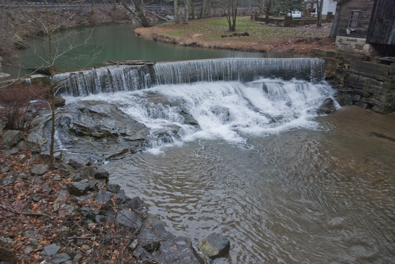
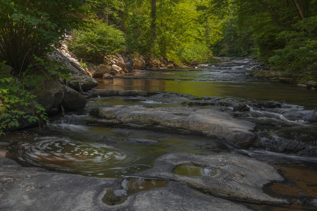
Beckwith is an unincorporated community in Fayette County, West Virginia. Beckwith is located on West Virginia Route 16 and Laurel Creek, 4.1 miles northwest of Fayetteville. It’s the place where the grand waterfalls of the Laurel Creek begin. The first fall is actually a dam. Just downstream from where you can first see the creek roadside. (38°06’02.2″N 81°08’56.3″W/38.100611, -81.148972)
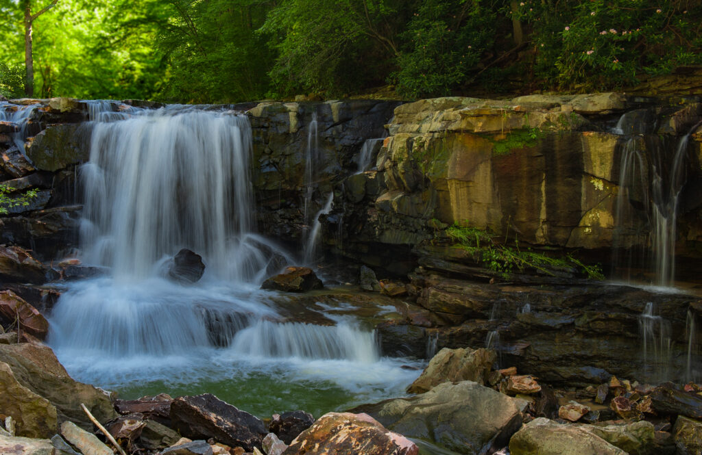
After the dam comes the first main falls. Most of these falls have no individual names. So, we’ll call this one number 2.
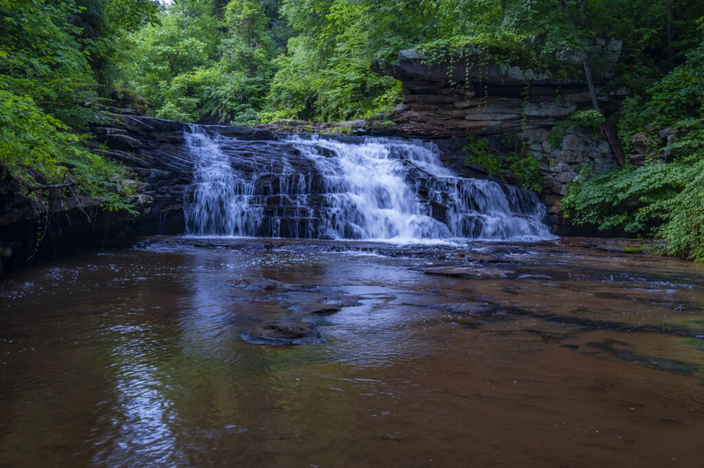
Not sure what this used to be but, as you can see, there is evidence of some sort of structure on the right. It appears to possibly be the remnants of an old mill or water wheel. But I don’t really know for sure. I like the broad flat space out in front of the falls. Very shallow and easy walking. A very picturesque place. You can creek walk from here down to the next fall, which is the first one that is easily visible from roadside.
Speaking of the roadside. This is a very, very dangerous stretch of road. Very curvy with lots of very fast moving traffic. There is very little space for roadside parking, so if you plan to go here, my best advise is to park at the top near the dam or at the bottom of the hill. Just across the Cotton Hill bridge is the road to Cotton Hill Fishing Access Area Parking. It’s an easy walk back up the creek. Just walk along the guard rail and access the creek anywhere you feel comfortable. You may find places that look like they have had some traffic. What ever you do, be forewarned that the hillside is covered with “rip-rap”. It’s pretty difficult to navigate to the creek bed in this environment. It would be very easy to fall and twist an ankle or worse.
That being said here they are from top to bottom beginning with the third from the top.
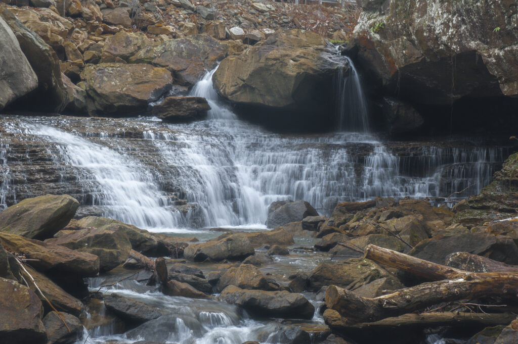
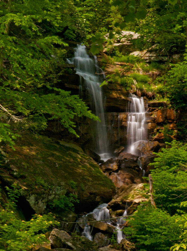
This little beauty is weather dependent and will probably only show itself in wet weather. Even then it’s not so easy to find, but if it’s running it should be visible from the road, tumbling down the mountain on the far side of the creek. Approximate GPS (38°06’28.1″N 81°08’58.0″W/38.107806, -81.149444)
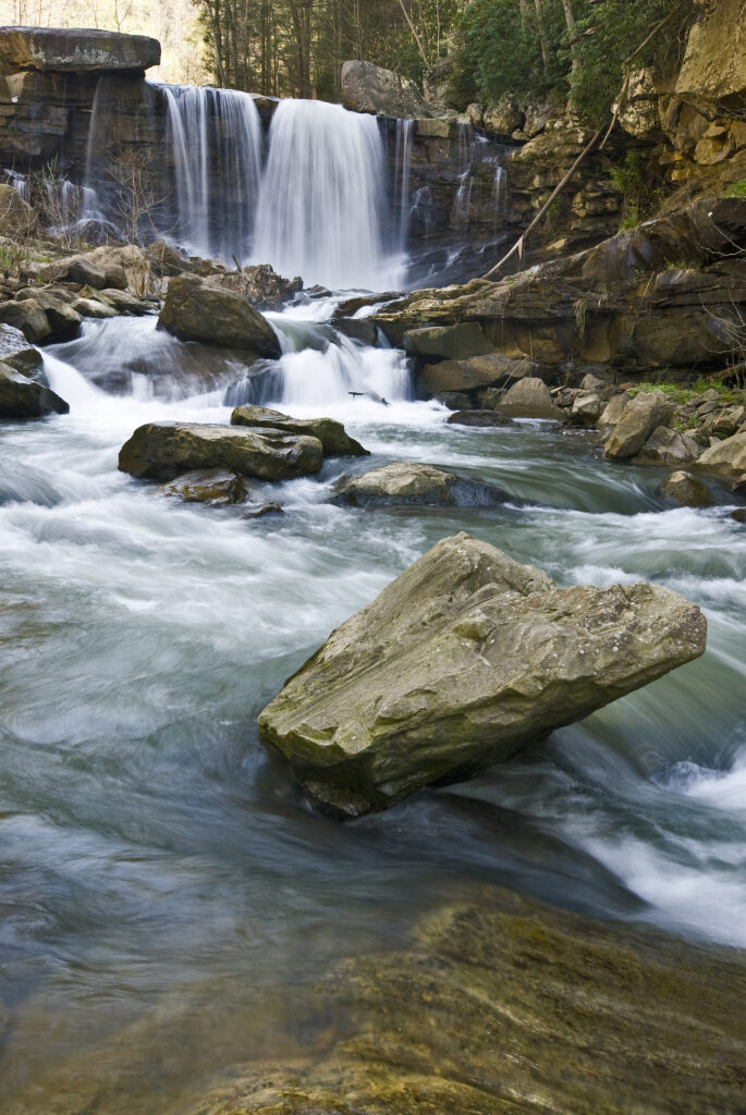
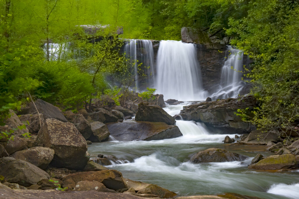
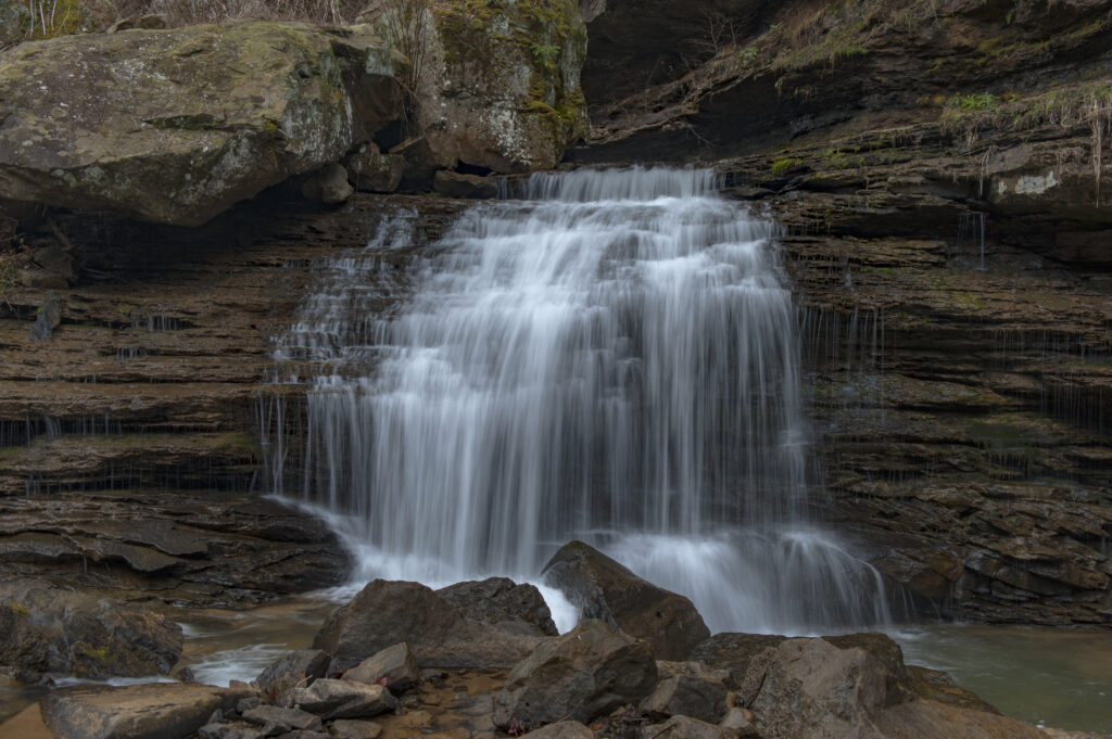
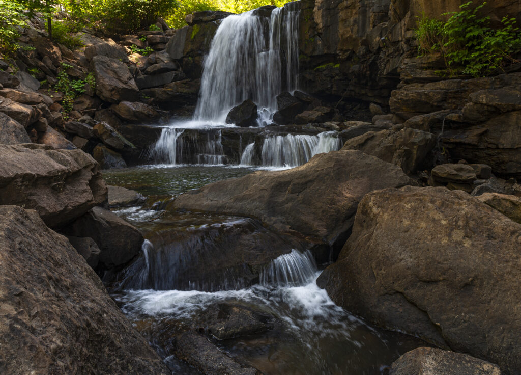
The last major fall, and the only named fall on this run, as far as I know, is called Captain Crunch. The locals, who swam here in their youth say it is called Misty Falls. But, apparently, more recently, it has been named by some kayakers, who knew no better and they called it “Captain Crunch”. Either way it’s the most spectacular fall on the run with many photographic possibilities. Here are two of my renderings.